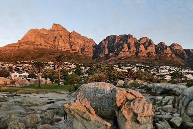

The main choice is the cableway or a hike; weather affects both, and trail routes vary in length and difficulty. Compare the ascent options below and check current cableway operations and mountain conditions on the day of your visit.
Choose your way up
| Option | Best fit | Check first |
|---|---|---|
| Cableway | A summit visit without a sustained climb. | Current operations, wind and ticket availability. |
| Platteklip Gorge | A direct but steep ascent on stone steps. | Fitness, water, daylight and your return route. |
| India Venster or Skeleton Gorge | Different trail experiences for prepared hikers. | Scrambling exposure or longer transport logistics, plus current conditions. |
Maclear's Beacon reaches 1,086 metres. The sandstone plateau is part of a SANParks-managed national park; its geology and plant life are explored below. Choose the ascent first, then plan the time you want on top.
Table Mountain Aerial Cableway: Tickets, Hours and Rotating Cabins
The Table Mountain Aerial Cableway has transported over 30 million passengers to the summit plateau since opening in 1929. The modern Swiss-engineered cable cars feature revolving floors that complete a full 360-degree rotation during the four-minute ascent, giving every passenger unobstructed panoramic views of Camps Bay, Lion's Head, and downtown Cape Town.
| Ticket Category | Time Window | Return Fare (ZAR) | One-Way Fare (ZAR) |
|---|---|---|---|
| Morning Adult (18+) | 08:30 to 13:00 | 420 - 450 ZAR | 240 - 260 ZAR |
| Afternoon Adult (18+) | 13:00 to Close | 380 - 400 ZAR | 220 - 240 ZAR |
| Child (Ages 4-17) | All Day | 210 - 230 ZAR | 120 - 140 ZAR |
| South African Senior (60+) | Valid ID Required | 130 - 150 ZAR | 80 - 90 ZAR |
Operating hours adjust seasonally. During peak summer (December to February), the first car departs upward at 08:00 and the final car descends at 20:30. In autumn and spring, closing times shift earlier to between 18:30 and 19:30, while winter operating schedules generally run from 08:30 to 17:00.
The cableway closes annually for two weeks in late July or early August for routine mechanical maintenance. Strong winds exceeding 35 km/h or thick cloud formations across the western face can trigger operational closures at short notice for safety reasons. Always check real-time operating status on the morning of your planned visit.
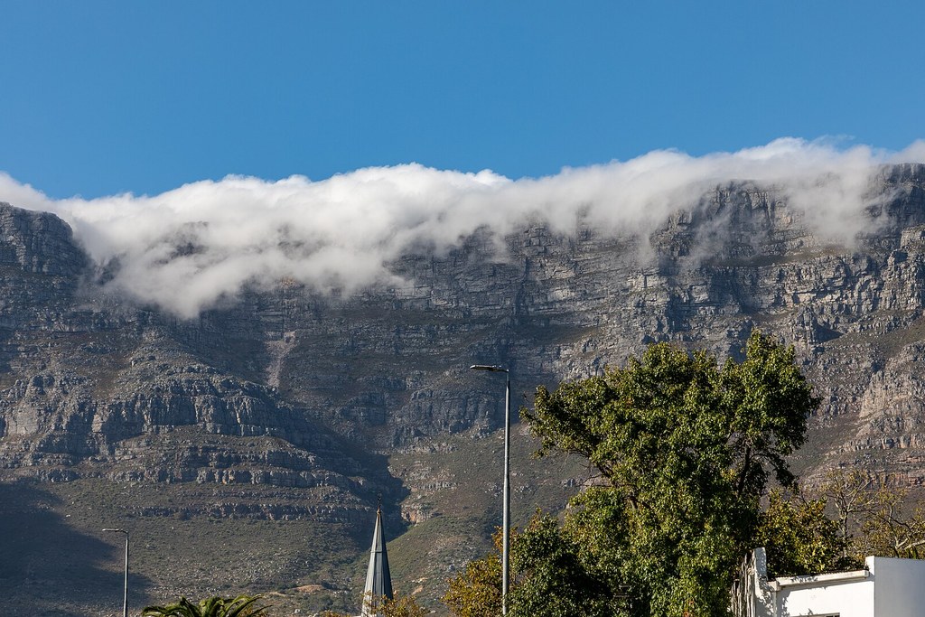
View of the Table Mountain plateau showcasing the dramatic Atlantic face and sandstone cliffs.
Summit Hiking Routes: Difficulty, Duration and Safety
More than 350 recognised trails crisscross Table Mountain. For visitors wanting to hike up or down, several well-trodden routes offer varying levels of physical challenge and scenery:
Platteklip Gorge: The Direct Classical Route
Platteklip Gorge is the most direct and popular footpath to the summit. The trailhead begins on Tafelberg Road roughly 1.5 km past the Lower Cable Station. The trail consists of continuous natural stone staircases cut into a deep vertical gorge on the northern mountain face.
- Distance and Ascent: 2.8 km one way, climbing 700 vertical metres.
- Duration: 1.5 to 3 hours depending on cardiovascular fitness.
- Trail Grade: Strenuous uphill walk; no technical scrambling or sheer drop-offs.
- Sun Exposure: Highly exposed to morning and midday sun, making early morning ascents before 08:00 strongly advisable in summer.
India Venster: The Scrambler Route
India Venster traces a line directly beneath the cableway cables. It offers dramatic views but requires scrambling over steep rock steps and holding metal chains and staples installed on exposed ledges. This trail is strictly intended for confident hikers with head for heights, and it should never be descended due to fall hazards.
Skeleton Gorge: Kirstenbosch to the Back Table
Starting inside Kirstenbosch National Botanical Garden on the eastern slope, Skeleton Gorge ascends through lush indigenous Afromontane forest, featuring wooden ladders beside waterfalls before reaching the Hely-Hutchinson reservoir and the summit plateau. It provides shaded climbing conditions, making it an excellent warm-weather option.
Footpaths winding through fynbos vegetation across the rocky summit tableland.
Exploring the Summit Plateau: Pathways and Flora
Once atop the mountain, visitors can explore three paved, level walking loops equipped with interpretative signboards:
- Dassie Walk: A 15-minute loop offering spectacular westward views looking down directly at Camps Bay, Clifton, and the Twelve Apostles.
- Agra Walk: A 30-minute circular route giving sweeping vistas over the Cape Town City Bowl, Table Bay harbour, and Robben Island.
- Maclear's Marker Trail: A 45-minute trek across the rocky plateau to the highest geographic point at 1,086 metres, marked by an 1865 stone cairn constructed by astronomer Sir Thomas Maclear.
The summit environment is home to the Cape Floral Kingdom, featuring King Proteas, red disa orchids, and fynbos shrubs adapted to acidic soils and seasonal fires. Rock hyraxes (locally called dassies), lizards, and birds of prey like the jackal buzzard and black eagle are frequently encountered along the paths.
The Tablecloth Phenomenon and Weather Precautions
The famous "Tablecloth" is an orographic cloud layer created when warm, moisture-laden southeasterly winds blow up the mountain slope from False Bay. As the air rises and cools at the summit plateau, moisture condenses into dense white clouds that roll over the northern face before dissipating in warmer air below.
While mesmerizing to watch from Camps Bay, being caught on the summit during sudden tablecloth formation brings thick fog, sharp temperature drops of 10°C or more, and reduced visibility under 10 metres. Trail markers can become difficult to spot. Hikers must carry warm windbreakers, headlamps, and follow designated pathways back to the Upper Cable Station without venturing near cliff edges.
Getting to Table Mountain from Camps Bay
Reaching the Lower Cable Station on Tafelberg Road from Place on the Bay requires minimal planning:
- By Ride-Hailing (Uber): Takes 8 to 12 minutes up Camps Bay Drive to Kloof Nek, then turning along Tafelberg Road. Drop-offs occur directly outside the ticket office.
- By MyCiTi Bus: Board Route 107 from Camps Bay to the Kloof Nek interchange, then transfer to the free MyCiTi shuttle bus (Route 110) that runs continuously along Tafelberg Road directly to the Lower Cableway.
- By Rental Car: Street parking is available along Tafelberg Road, but spaces fill rapidly after 09:00 during summer. Arriving early or using Uber avoids parking delays.
Maclears Beacon and the summit
At the eastern extremity of the summit plateau stands Maclears Beacon, rising 1,086 metres above sea level as the highest geographic point on Table Mountain. Constructed in 1865 by astronomer royal Sir Thomas Maclear to measure the curvature of the Earth and verify the meridian arc, the stone triangulation cairn remains a premier hiking objective. Reaching the beacon from the Upper Cable Station involves an easy 45-minute traverse along well-marked rocky paths across the central table, passing seasonal rock pools and sheer northern cliff faces overlooking the City Bowl.
Ascending the mountain via public transit is an engineering experience in its own right. The modern Table Mountain Aerial Cableway operates Swiss-manufactured Rotair gondolas featuring rotating circular floors. As each cabin ascends along the 1,200-metre steel cable span, the floor completes a full 360-degree rotation, granting every passenger panoramic perspectives of Lion's Head, Camps Bay, and Table Bay without shifting positions. The cable system uses computer-monitored hydraulic counterweights designed to manage high-altitude mountain gusts up to defined safety limits.
Table Mountain serves as the northern bastion of the Cape Floral Region Protected Areas, recognized globally as a UNESCO World Heritage site for extraordinary plant biodiversity. The national park protects more than 2,200 plant species across distinct Fynbos habitats, encompassing more indigenous botanical varieties than the entire United Kingdom. Along the pathways, visitors regularly observe indigenous rock hyraxes (locally known as dassies), orange-breasted sunbirds sipping nectar from protea blossoms, and territorial black girdled lizards sunning on warm sandstone slabs.
Mountain weather conditions shift rapidly. When southeasterly trade winds known as the Cape Doctor encounter the 1,000-metre vertical cliffs, moisture undergoes rapid orographic cooling to create the iconic tablecloth cloud cascade. Strong summit winds exceeding 40 knots trigger automatic safety suspensions at the cable station, requiring visitors to monitor real-time cableway operational status before setting out.
Frequently Asked Questions
How far in advance should I book Table Mountain cableway tickets?
Purchasing tickets online in advance is strongly recommended during summer and holiday weekends to bypass general ticket queues. Online tickets remain valid for seven days from the selected date.
What happens to tickets if the cableway closes due to high wind?
If the cableway closes due to adverse weather conditions, pre-purchased tickets remain valid for future days or can be refunded online via the official booking portal.
Can I hike up Table Mountain and take the cable car down?
Yes, many hikers ascend via Platteklip Gorge or Kasteelspoort and purchase a one-way descent ticket at the Upper Cable Station ticket office or online.
What should I wear when visiting the mountain summit?
Temperatures on the summit are typically 5°C to 10°C colder than at sea level. Bring a warm layer or windbreaker, comfortable closed walking shoes, sunglasses, and high-SPF sunscreen.